I-MAG STS Corporation
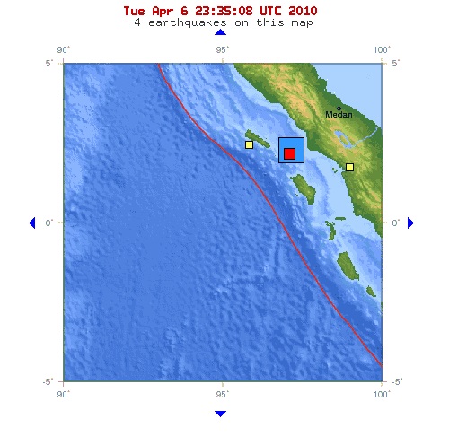
Map courtesy United States Geological Survey. Initially, the yellow squares to the east and west
appear to be unrelated to the 7.7 (blue square - at 2.360 N 97.132 E 31.0 km deep at 22:15 UTC) or
the 5.1 aftershock (red square - at 2.270 N 97.077 E 35.0 km deep at 22:54). Nias Island is where I
predicted the next large (> 8.2, so have missed on that - so far) "southwestern" Indonesian
earthquake some years ago. Nias is one of the arcs of the South Sumatran Basin along the famed
Sunda Trench subduction zone. I will be curiousto see if this event changes the subduction velocity
(oceanic plate under Asian plate) - last I looked it was over 50 mm annually.