I-MAG STS Corporation
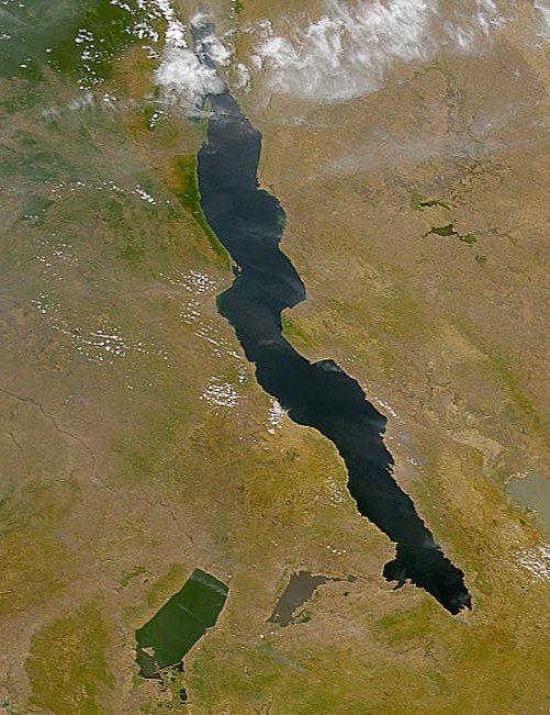
Lake Tanganyika (image to the right as seen from space) is about 700 kilometers
long and 60 kilometers wide. It is generally reckoned Earth's second largest
freshwater lake behind Lake Baikal. It has a maximum water depth of almost
1500 meters, with another 4500 meters of sediment above actual bedrock. Today,
it is largely drained by the Congo River system and fed by Lake Kivu via the
Ruzizi River and by the Malagarasi River. Prior to Lake Tanganyika, the
Malagarasi was joined with the Congo in one transcontinental river.
Lately, fishery yields from the lake have been declining dramatically. This is
alarming as the growing regional population depends on the protein. IMAG
STS extrapolations indicate a crisis by 2010 - assuming there is no major
geological event in Lake Kivu, and that nothing stronger than the 6.6 Richter
event of December 5 2005 disturbs Lake Tanganyika. Some technical references
listed below
1. Verschuren, D in Nature 424, 731 - 732 (14 Aug 2003) News and Views
2. "Climate change decreases aquatic ecosystem productivity of Lake Tanganyika,
Africa" by Catherine M. O'Reilly, Simone R. Alin, Pierre-Denis Plisnier, Andrew
S. Cohen, Brent A. McKee, same issue, pages 766-8.
3. "Ecological Consequences of a Century of Warming in Lake Tanganyika"
by Piet Verburg, Robert E. Hecky, Hedy Kling Science 25 July 2003 301: 505-507
| Prior |