I-MAG STS Corporation
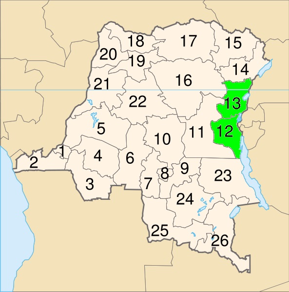
Lake Kivu is located between Rwanda and the Democratic
Republic of the Congo. On the map to the right Lake Kivu is
the small blue oval at the bottom right of area 13 - which is
the Congolese province of North Kivu. The lake is about 90
kilometers long from north to south and about fifty
kilometers at its widest. Despite depths that go to nearly 500
meters, Lake Kivu contains the island of Idjwi, one of the
largest inland islands in the world. The lake has a surface
area of about 2700 square kilometers and a volume of 500
cubic kilometers. The lake surface is above 1450 meters in
elevation, which means it naturally flows downhill into the
Ruzizi River, which continues south in Lake Tanganyika,
which is the large blue area at the bottom right of area 12 -
which is the Congolese province of South Kivu. Analysis of
lake sediment cores by geologist R.E. Hecky and others
shows that there have been at least five major events in the
last several thousand years. Lake Kivu is meromictic which
means that gases like methane and carbon dioxide, most
likely from volcanoes, accumulate below 300 meters. There
are in excess of sixty BILLION cubic meters of gas trapped in
the lake now. In the event of a 6.0 or greater earthquake or a
major eruption from Nyiragongo, some or most of the gas
will escape to the surface. Depending on the volume, the
explosion will rival Hiroshima, there will be tsunamis with
200 meter or higher run-up and massive loss of life. The
severe ecological damage to the lake will destroy the
fisheries, a major source of protein, impact irrigation and
cause drinking water shortages.
| Prior |