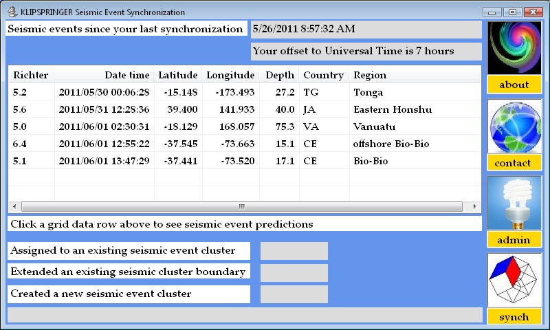
| Note that by convention negative latitudes are SOUTH of the Equator, while negative longitudes are WEST of Greenwich England. The latitude and longitude are interpreted as the epicenter, but generally the damage area of the actual earthquake extends (often in two dimensions) depending on the power of the seismic event. A Richter 5.0 might barely be felt a kilometer away, while Richter 9.0 typically causes huge deformations extending hundreds of kilometers. Estimated Depth is given in kilometers. Countries are abbreviated with FIPS codes to save display space here as the standard netbook display area is 800 x 480. As earthquakes and tsunamis are notoriously unconcerned about visas, the notion that an epicenter is associated with a country is being questioned. The Richter scale is logarithmic - a 5.2 is two times stronger than a 5.1, a 7.3 is 10 times stronger than a 6.3, and a 9.4 is 100 times stronger than a 7.4. Note that when the synch philleme (picture and text lower right corner) is clicked your local database is updated and the events will not be shown again. |