| Prior Click here |
| Next Click here |
Being somewhat contrarian, our prediction software assigned the relatively highest chances of one or more major events to the purple triangles, presumably on grounds there was unrelieved pressure there. There were roughly order of magnitude lower probabilities assigned to the southernmost yellow cluster, the white cluster and the southern red cluster. Somewhat still lower chances for the central orange and northern blue clusters.
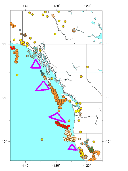
Vancouver Island is located in the southwestern corner of the province of British Columbia. It is separated from the mainland by the Johnstone Strait and Queen Charlotte Strait northeast; the Strait of Georgia southeast; and the Strait of Juan de Fuca southwest. A major marine earthquake in or near any of these areas would be very damaging. The poorly understood Vancouver Island event of June 23, 1946 was a Richter 7.3 with an epicenter near the central eastern shore. The more powerful (Richter 8.1) but less damaging Queen Charlotte Islands earthquake of August 22, 1949 (gray dots near the top of the second highest triangle) remains Canada's strongest measured event to-date.