| Prior Click here |
| Next Click here |
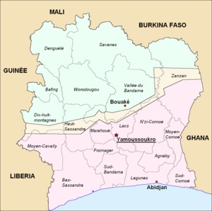
On the left our 2002 projection of how the Ivory Coast might be divided by uncivil war into, for lack of
better names, the Ivory (north) and the Coast (south). On the right, the theoretical map, including a
buffer zone, produced as part of the 2007 peace conference. Unfortunately, neither rifles nor creative
cartographies trump economics in the long run - there was just no scenario then or now where the
northern fragment is economically viable. Nor was it feasible to slice off portions of the north and give
them to neighboring countries like Burkina Faso or Mali. Serious economic difficulties in even just the
southern portion should have been expected to have disastrous effects on Liberia, Ghana and others.
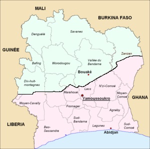
from the archives